Rohtang sits on the highway between Manali and the Lahaul-Spiti Valley, and for centuries it has been less a destination than a threshold — the line between the green, monsoon-fed Kullu Valley and the arid Buddhist highlands beyond. Every year, roughly two million visitors make the climb, most of them between May and November, transforming the pass into one of the most visited high-altitude crossings on the planet. What follows is a look at its layered history, the radical personality shift it undergoes across seasons, the activities that draw crowds and thrill-seekers, and practical information for getting there without losing your mind — or your clutch plate.
The Pass That Killed Enough People to Earn Its Name
Rohtang derives from a Persianised form of the local phrase "Ro-htang," meaning "pile of corpses." The name isn't metaphorical. For centuries, travellers, traders, and soldiers died here in snowstorms, avalanches, and sudden whiteouts that could reduce visibility to arm's length. The pass was a critical link on the ancient trade route connecting the Kullu Valley to Lahaul, Spiti, and eventually Ladakh and Central Asia. Caravans carrying salt, wool, and dry fruits crossed it during the narrow summer window, gambling against the weather each time.
The British colonial administration surveyed Rohtang in the nineteenth century as part of broader efforts to map the Himalayan frontier. They built a rough bridle path, which subsequent Indian governments upgraded — slowly, grudgingly — into the modern highway. The road remained seasonal and treacherous well into the twenty-first century, often closing without warning due to landslides or early snow. Hundreds of vehicles would queue for hours, sometimes overnight, engines running to keep heaters alive.
The opening of the Atal Tunnel in 2020 changed the equation dramatically. This 9.02-kilometre tunnel, bored through the same Pir Panjal range at a lower altitude of 3,060 metres, now provides year-round access to Lahaul-Spiti, bypassing Rohtang entirely for through-traffic. The pass lost its strategic chokehold on the valley beyond. Yet the crowds still come — not to cross, but to stand at the top, to touch snow, to feel the altitude squeeze their lungs.
The irony is thick. A pass named for death has become a playground. The Gaddi and Lahauli communities who depended on it for survival now watch tourists pose for photographs at the same spots where their ancestors perished. Rohtang's history isn't ancient or decorative. It's a living tension between utility and spectacle, between a road that was feared and a destination that is craved.
Four Faces of the Same Mountain Road
Winter buries Rohtang under metres of snow, typically from late November through April. The pass closes to civilian traffic entirely during this stretch. Snowfall can exceed five metres in accumulated depth, and the Border Roads Organisation — the agency responsible for maintaining the highway — withdraws its crews to lower elevations. The silence up there in deep winter is absolute, broken only by wind and the occasional crack of ice shifting under its own weight.
Spring brings the slow, violent thaw. By late April, BRO bulldozers begin carving through compacted snowdrifts to reopen the road, a process that takes weeks. The pass in May is a bizarre landscape: walls of dirty snow five or six feet high flanking a narrow lane of wet asphalt, with meltwater streaming across the road surface. Temperatures hover near freezing at the summit even as Manali, 51 kilometres south and 1,900 metres lower, basks in pleasant warmth.
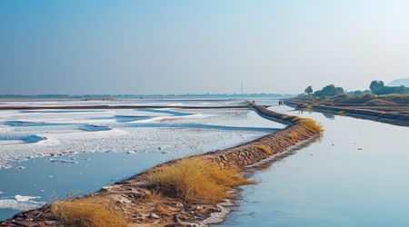
Summer, from June through August, is when Rohtang shows its greenest face. The south-facing slopes erupt with wildflowers — blue poppies, primulas, potentillas — fed by monsoon moisture that pushes up from the plains. Fog rolls in unpredictably, though, and the road becomes a slick gauntlet of mud, loose gravel, and water crossings. July and August are the wettest months, and landslides can close the road for days at a time.
Autumn — September and October — is the pass at its most cooperative. Skies clear. The air sharpens. Snow hasn't yet arrived, and the monsoon has retreated. You can see the peaks of the Pir Panjal with startling clarity, the kind of visibility that makes distances feel dishonest. This is the window most experienced travellers prefer, though it's the one fewest tourists choose. The crowd calendar and the quality calendar rarely overlap at Rohtang.
Snow That You Earn at Nearly Four Thousand Metres
Most visitors who reach Rohtang between May and early June come for one thing: snow. The pass retains snowpack along its upper slopes well into summer, and a small industry has grown around it. Operators rent gumboots, snow suits, and rudimentary ski equipment near the summit. The gear is often mismatched and well-worn — don't expect anything calibrated to your size — but it gets the job done for an hour of sliding around on hard-packed snow.
The core snow activities available near the pass include:
- Snow tubing on inflated rubber rings, pulled uphill by operators and released down groomed chutes — the closest thing to a controlled thrill ride at this altitude.
- Sledging on wooden or plastic sleds across compacted snowfields, often accompanied by a guide who doubles as a brake system.
- Snowmobile rides along short, designated tracks near the summit parking area, priced by the minute and negotiated on the spot.
- Impromptu snowball fights and snow-walking excursions across the upper slopes, unguided but popular with families.
Altitude is the thing nobody prepares for. At nearly 4,000 metres, oxygen levels drop to roughly 60 percent of sea-level concentration. Visitors who've driven up from Manali in a couple of hours often feel dizzy, nauseous, or short of breath within twenty minutes of stepping out. The temptation to run and play in snow is understandable; the body's capacity to do so is sharply reduced. Drink water. Move slowly. Sit down if your temples start to pulse.
The commercial snow zone near the top operates with minimal regulation. Pricing is fluid, haggling is expected, and safety standards are informal. Wear layers — not cotton — and bring sunglasses, because the glare off snow at this altitude can burn your retinas faster than you'd expect. The fun is genuine, but it demands a degree of self-reliance that the Instagram posts rarely convey.
What Happens Below the Snowline Between May and October
The road to Rohtang Pass is itself the adventure. Between Manali and the summit, the highway climbs through dense deodar forests, crosses the tree line near Marhi, and traverses a series of hairpin bends that test both driver and vehicle. Along this gradient, a range of warm-weather activities has taken root, concentrated mainly in the Solang Valley and the Gulaba checkpoint area.
Solang Valley, about 14 kilometres from Manali on the Rohtang road, is the hub. Paragliding tandem flights launch from slopes above the valley floor, offering ten to fifteen minutes of airtime depending on thermals. The landing zone is a grassy meadow where operators pack and repack chutes with the casual rhythm of assembly-line workers. Zorbing — rolling downhill inside a transparent inflatable sphere — is available on the same slopes, a peculiar sensation that combines motion sickness with childlike delight in roughly equal measure.
Mountain biking routes trace the lower sections of the highway and branch off into side valleys. The descent from Rohtang back toward Manali, if you have the nerve and a competent bike, covers nearly 2,000 metres of elevation loss over 51 kilometres — a ride that turns your brake pads to dust and your knuckles white. Several operators in Manali rent bikes and arrange support vehicles for this run.
River rafting on the Beas River picks up volume during monsoon months, with Grade II and III rapids between Pirdi and Jhiri offering a manageable rush for beginners. The water runs cold and grey-green with glacial silt, and the rapids, while not extreme, demand attention. Trekking routes branch off the main road at multiple points — the Beas Kund trek, which traces the river to its glacial source, starts near Solang and takes two to three days. None of these activities require Rohtang itself, but the pass road is the spine that connects them all.
The Permit, the Traffic, and the Altitude Tax on Your Body
You cannot drive to Rohtang Pass without a permit. The Himachal Pradesh government restricts the number of vehicles allowed per day — typically around 1,200 — to manage congestion and environmental damage. Permits are issued online through the district administration's portal, and you need to apply at least a day in advance. During peak season, slots fill quickly. Your vehicle registration number, driver ID, and passenger count are all required at the time of booking. No permit, no passage past the Gulaba checkpoint.
The practical logistics break down like this:
- Distance from Manali to the pass is approximately 51 kilometres, taking three to four hours by road depending on traffic and conditions.
- The road opens to tourists generally between May and November, though exact dates shift with snowfall patterns.
- Petrol stations don't exist beyond Manali — fill up before you leave, and carry extra fuel if your vehicle is thirsty.
- Medical facilities along the route are minimal; carry a basic first-aid kit and any altitude sickness medication (acetazolamide is widely recommended) in advance.
Hiring a local taxi or joining a shared vehicle from Manali is the path of least resistance. Local drivers know the road's moods — which turns flood after rain, which stretches ice over first, where rockfall is likeliest. Private vehicles with low ground clearance suffer on the upper sections, especially during monsoon months when the road degrades into a sequence of potholes and rivulets.
Dress in layers regardless of the season. The temperature difference between Manali and the pass summit can be 15 to 20 degrees Celsius. Carry water, snacks, sunscreen with high SPF, and a rain shell. The weather at the top changes within minutes. You can leave under blue sky and arrive in fog so dense that the car ahead disappears. Plan for the worst version of the day, and let the good weather be a bonus.
The Valleys That Wait on the Other Side
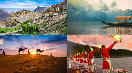
Rohtang is a doorway, not a dead end. Cross the pass — or bypass it through the Atal Tunnel — and you enter the Lahaul Valley, a landscape so different from Kullu that it feels like a border crossing between climates. The green canopy vanishes. The air dries out. Rock faces in shades of rust and charcoal rise above the Chandra River, and Buddhist monasteries perch on ridges that seem engineered to test human devotion to inconvenience.
Keylong, the administrative headquarters of Lahaul-Spiti, sits about 115 kilometres from Manali and serves as a staging post for deeper exploration. From here, the road splits: northwest toward Udaipur and the Pattan Valley, east toward the Kunzum Pass and the Spiti Valley. Spiti, in particular, rewards those willing to endure hours of rough road with a severity of beauty that Rohtang's crowds will never experience. The monastery at Tabo, founded in 996 CE, holds murals that predate most European cathedrals. Ki Monastery sits on a conical hill above the Spiti River, layered like geological strata.
Closer to Rohtang, the Chandra Tal lake — roughly 65 kilometres from the pass — sits at 4,300 metres in a glacial bowl. The water shifts between turquoise and steel blue depending on sunlight and cloud cover. Camping is permitted near the lake between June and October, though nights drop below freezing even in summer. The approach road is unpaved and narrow enough to make two passing vehicles an exercise in mutual faith.
Treating Rohtang as the destination rather than the gateway is like visiting an airport and never boarding a flight. The pass has its own stark appeal, certainly, but the territories it guards — Lahaul, Spiti, Pangi — are where the Himalayas stop performing for tourists and simply exist, indifferent to whether anyone is watching.
Rohtang Pass occupies a strange position in Indian travel culture — simultaneously overhyped and underestimated. Overhyped because the pass itself is a windswept highway crossing, not a summit, and the tourist infrastructure around it is scrappy at best. Underestimated because the road there, the altitude, and the sheer geological drama of the Pir Panjal range deliver something that careful itineraries rarely capture: the physical sensation of crossing from one world into another.
The crowds will keep coming, the permit system will keep tightening, and the Atal Tunnel will keep siphoning through-traffic underground. But the pass will remain what it has always been — a threshold where the familiar ends and the difficult begins, and where the price of the view is paid not in rupees but in the burning of your lungs at four thousand metres of thin, indifferent air.